Research Fellow Kerryn Little is helping develop an effective, tailored UK fire danger rating system. She explains to Old Joe why she cares so much and the difference alumni volunteers have made through 'citizen science'.
Record temperatures in the 2022 UK heatwave highlighted the dangers posed by extreme weather conditions fuelled by climate change.
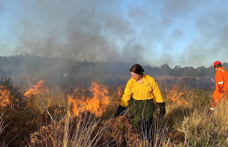
England alone experiences more than 30,000 wildfires each year and July 2022 saw fires breaking out across the country that even threatened urban areas. Close to the University, five hectares of land in Lickey Hills Country Park was ablaze, requiring local residents to evacuate their homes.
Kerryn Little, working with the Natural Environment Research Council to develop the scientific base for the UK's first fire danger rating system, has first-hand experience of the urgent need for such a system to be in place.
Personal stake
Growing up in the city of Dunedin in New Zealand, Kerryn volunteered for the Wakari Rural Fire Brigade for two years.
New Zealand uses a five-level rating system to warn local communities of imminent danger from a vegetation fire, but no such effective UK system exists.
Kerryn’s PhD research, working alongside Professor Nick Kettridge, an expert in Ecohydrology at the University, aims to change that.
She explains: 'As a volunteer firefighter I dealt with vegetation fires. While New Zealand is more rural, the UK has a much larger population with more contained rural areas. That raises the threat of wildfires with serious consequences for people and infrastructure that border these rural areas.
'That was where I started to see a need for this research, discovering there were a lot of gaps in our knowledge where the creation of a fire danger rating system for the UK would be important and beneficial to the future.'
Across the planet, temperatures are on the rise. The UK landscape is becoming drier, and part of the necessary response to that is to understand what are the dangers we face in terms of wildfires.
Calling in the volunteers
In the UK, shrubs like common heather (Calluna vulgaris) are important fuel for wildfires on heathland and peatland. The drier the vegetation, the more flammable the fuel, and the greater the potential number, size and consequences of the fires.
Knowing in advance where the driest areas are allows preventative action to be taken, which is where Kerryn's research comes in. She was taking samples of heather from the North York Moors to analyse how much moisture they held, but the team did not have enough people to successfully broaden that research across the country. Citizen science held the answer.
She adds: 'The fuels in the UK are quite different to the places where warning systems have typically been developed. In heathland and peatland environments, we don't fully understand how moisture is retained in the vegetation generally, nor how it varies across the country.
'So far, we have used intensive field studies in localised areas to develop our understanding of moisture dynamics. But it really needs to be scaled up, and that is where we needed help from people across the country.'
Citizen Science
150 alumni and supporter volunteers, living as far afield as the north of Scotland, Cornwall, Wales and Northern Ireland, were asked to collect samples of heather clippings during a dry spell on 19 April, as a wildfire burned in Marsden Moor in the Peak District, and a wildfire warning was issued across Scotland.
The clippings were sent to the University in air-tight containers for the team to measure the foil moisture content – weighing the clippings upon arrival before the samples were dried in an oven and then weighed again.
'Using citizen science was really the only way we could upscale the research we were already doing and gather data across the whole of the UK,' explains Nick.
'We know our communities care about the environment and want to help. If we can explain how our research can make a difference, we can all work together on solutions.'
That help has come not only from those who live near to heathland and walk their dogs, but also from park rangers or site managers of professional organisations with a vested interest in managing land and the danger of wildfires appropriately.
Nick adds: 'We didn't know what the response would be at all, but we've been absolutely blown away by the volunteers - more than 900 samples from right across the UK, 55% taken on a single day and 80% within a two-day period of high fire danger.
'But more than that, it has been amazing to see the notes, discussions and enjoyment of the sampling by people. A massive thank you to everyone who has volunteered.'